MarineTraffic
Always up-to-date – ship tracking with MarineTraffic
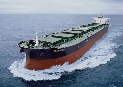
MarineTraffic is a ship-tracking and maritime information service that was founded by Dimitris Lekkas in 2007. It is widely recognised as the world’s most comprehensive maritime database and the service is able to boast more than six million unique monthly users, as well as more than one million registered account holders. Essentially, the service was set up by Lekkas because he had an existing interest in computers and ship spotting and had become interested in the practical uses of AIS vessel tracking technology. Little did he know, he was about to create one of the most important transport databases in the world. The MarineTraffic service is available to use for free, although a paid version also exists, adding more advanced features. MarineTraffic makes use of AIS vessel tracking technology to record 800 million vessel locations each month, while its database also includes information on ships, such as when and where they were built.
How Does MarineTraffic Work?
The MarineTraffic service makes use of AIS tracking technology to provide information about the identification, course, speed and current location of vessels. From there, locations can be overlaid onto Google Maps, and, as a result, users can use the service to track the movements of ships and other vessels in real-time.
Additionally, some information surrounding ship locations is self-reported by those aboard. This information is then used to provide a more accurate and up-to-date live map of vessel locations.
Aside from tracking vessel positions, MarineTraffic also provides background information on vessels, such as where they were built, when they were built, their IMO (International Maritime Organisation) number, how much they weigh and even photographs of them. Much of this information is submitted voluntarily by the community members.
What is AIS Technology?
AIS stands for ‘automatic identification system‘ and refers to a tracking system that is used on ships and VesselFinder. Since 2004, it has been compulsory for all passenger ships of any size, and all international voyaging ships with a gross tonnage of 300 or more, to be fitted with an AIS transponder, which is able to transmit and receive AIS data.
The AIS transponder transmits GPS information, as well as a host of additional data, which is then received by AIS receiving stations. The MarineTraffic service makes use of more than 3,000 of these stations, positioned all around the world, allowing the service to track positions, identify vessels, plot courses and even monitor speed.
In many ways, the MarineTraffic AIS technology can be considered similar to the flight radar technology used by services like Flightradar24, in order to track aircraft. In that particular case, the AIS technology is replaced by ADS-B technology, which works in a similar way and is again assisted by volunteers, with information being picked up by ADS-B receivers or receiving stations instead of AIS receivers.
Other information on the site
While the information on the site largely revolves around picking up these AIS signals for tracking purposes, background information about the vessels, photographs of ships and an abundance of other information is also added and moderated by volunteers, who make up the core of the MarineTraffic community.
Meanwhile, in addition to the automatic location tracking that is provided through the use of AIS technology, vessel positions are also often self-reported to MarineTraffic. This can help to make tracking even more accurate and is stored as historical data within the database. It can subsequently be referred to for statistical analysis, emergency response purposes, accident investigation, and even to assess the effects of weather on speed.
Who Uses MarineTraffic?
An online ship tracking service may seem like the sort of platform that would only appeal to the most dedicated ship spotters, and it may not surprise you to learn that the site’s founder, Dimitris Lekkas, places himself within this category. However, in reality, the service has a much wider audience than that.
In fact, in the years since its initial launch, MarineTraffic has grown into an important tool for both business and research purposes, while the platform is also used by governments, trade organisations and emergency services. Of course, it remains a valuable tool for maritime professionals and hobbyists as well.
Core Users
The core user group includes maritime professionals, ship spotters and other hobbyists. Many of those within this group subscribe to the paid version of the service and dedicate their free time to voluntarily help the community, upload photographs and moderate content uploaded to the site.
Business and Trade
Another key use for the MarineTraffic service is related to business and trade. Its primary use here is to track the progress of cargo being shipped overseas. Furthermore, the website includes its own business directory, helping to put buyers and suppliers in contact with one another.
Research
MarineTraffic also enjoys popularity with maritime researchers and those interested in AIS technology. Indeed, the service has set up the MarineTraffic Research Network, which is designed to assist academic institutions, research foundations and individual maritime researchers. Interested parties can even apply for special academic accounts.
Security and Emergency Services
One of the more surprising ways in which MarineTraffic is used is as a tool to assist emergency services with situational awareness and accident investigation. Moreover, the platform has also been used by some national governments for security purposes because it allows them to monitor activity in and around their coastal areas.
Other Users
Aside from the groups mentioned, MarineTraffic has also grown into an important resource for journalists and media organisations, who have used it to inform reports on ISIS and the migrant crisis. In addition, there are also casual users who may utilise MarineTraffic to track friends or family members aboard a ship or vessel.
How Do You Use MarineTraffic?
If all of this seems complicated and overly technical so far, the good news is that the actual MarineTraffic service itself is very easy to use, even for those with no technical knowledge of AIS technology whatsoever. Additionally, the core features can be accessed from a range of different platforms. The main website is, in itself, the service’s web platform and from there, users will be able to search for, identify and track vessels. However, in addition to this, two separate web apps exist. The first of these integrates with the services seen on the web platform, while the other is designed for boaters and hobbyists.
Web Platform
The main MarineTraffic web platform features a Live Map showing the positions of vessels. Users can click and drag the map to move around the globe, highlight vessels on the map to find out more information, or use the ‘+’ an ‘-‘ symbols to zoom in or out, while the left-hand side of the screen has a range of more advanced options.
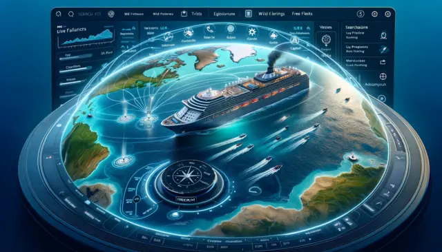
At the top, the magnifying glass symbol opens up the search function, allowing users to search for either a vessel or sea port, or search for a specific map location. Meanwhile, the filter symbol allows users to filter the vessels displayed on the map based on ship type, capacity, current status and more.
Finally, the symbol showing three boats is the ‘My Fleets’ option. By accessing this menu, users have the option to create a fleet and add ships to it, making it easier to track multiple vessels at the same time.
A basic MarineTraffic account is free and can be used for an indefinite period. However, MarineTraffic is categorised as a ‘freemium’ service because a paid premium account opens up a range of extra features. Among these are the ability to create larger fleets, use custom fleet icons, access wind forecasts and view a 30-day voyage history.
Mobile Apps
Aside from the main web platform, the MarineTraffic service also has two separate mobile apps, which are available for Android and iOS devices. The first of these, MarineTraffic Ship Positions is similar to the web platform, but is more mobile-friendly than using the website on a mobile browser.
All account holders can make use of the app, including those with a basic free account, those with a paid premium account, or those with a special research or academic account, but the app itself is not free, and a small fee is required to download it. The features available within the app will depend on the account type held by the user.
Further to the main MarineTraffic mobile app the platform also has a separate mobile app, known as MarineTraffic OnCourse. This app is intended for those interested in sailing or yachting or those who are in charge of larger vessels, and provides a more advanced range of features. For example, the app allows boaters to self-report their location from within the app and easily upload photos and other information about their vessel.